Back in the early 1600s, when Captain John Smith first explored the Chesapeake Bay, he called Old Point Comfort, “A little isle fit for a castle.” As ships enter the Bay, the island that became home to Fort Monroe lies straight ahead, on the north side of the entrance to Norfolk Harbor, and throughout our nation’s history, until just recently, army leaders have used its strategic location to great advantage.
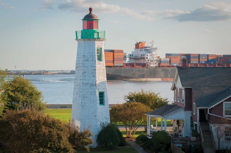
On our trip up the Intracoastal Waterway (ICW), we were looking at some weather on the Bay that made us decide to stay put and wait it out. We wanted to be in a safe harbor, but we wanted to be as close to the Chesapeake as we could to make our break just at the right moment. Upon investigating marinas in the Hampton area, we found Old Point Comfort Marina.
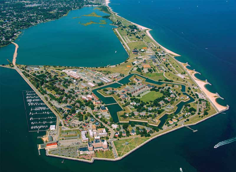
This whole island has had major significance throughout our nation’s history, and the island’s crown jewel is a seven-sided star fort, the largest ever built in the United States, that’s open for the public to stroll through free of charge. The fort, which is a National Park, houses the Casemate Museum, with all the details of its history.
Construction of the current fort began in 1819 was completed in 1834. Named for President James Monroe, the stone fort is known as the largest built in the U.S. It’s well-known for its role in the Civil War. Although Virginia was a Confederate state, Fort Monroe continued to be within Union control. Its commander took the position that escaping male slaves who made it to Union lines would be deemed contraband and not sent back to bondage. The determination gave rise to thousands of slaves fleeing to Union lines around Fort Monroe, and it grew to be known as “Freedom’s Fortress,” as any slave reaching it would be free.
Though this place is rife with historical significance, another great thing about this place is the community growing here. Until 2011, this site and the whole island belonged to the Army, which maintained a working military base here. On this island, you’ll find a beautiful little community of old brick duplexes, indicative of military housing. The housing here is “for rent” to all comers, no military background required. The buildings are available for rent only, as a means of keeping some control over the historic significance. However, anybody who appreciates safe, tree-lined streets with well-built brick homes and facilities nearby is welcome to apply to rent one of these homes. The Army’s old offices are available for rent, too, and architects, lawyers, and other professionals have set up shop here.
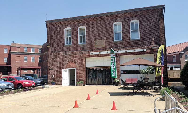
In keeping with the way most military bases are set up, there are services available on site. Since the Army gave up control over this island, the services are run as civilian businesses. The old firehouse has been turned into a coffee shop out of which Segway tours are run. One of the old buildings has been turned into a craft brewery. Next door to the marina there’s a casual seafood restaurant. This little island boasts churches, a bank, a YMCA, a childcare facility, a movie house (we heard it is being turned into a community theater), and senior living in the form of a grand old hotel. And, of course, the museum.
A great many cruisers travel to and through Hampton Roads who would never think to turn west at the mouth of the harbor, but there’s a hidden little gem at the Old Point Comfort Marina on the island where Fort Monroe stands. We were pleasantly surprised to find a charming community and a long and storied history. After our stay, we decided we will definitely be back.
Arriving by Water
Arriving by boat to this pretty little community, you'll need to turn off the main channel through Norfolk Harbor and head northwest. About a mile up you'll find green #3 marker. Turn east into the marina. They have a breakwall to protect the marina at an unusual angle and depending on which end of the marina you're going to, you'll need to negotiate that.
By Elizabeth Kelch