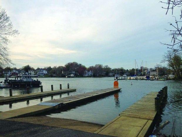
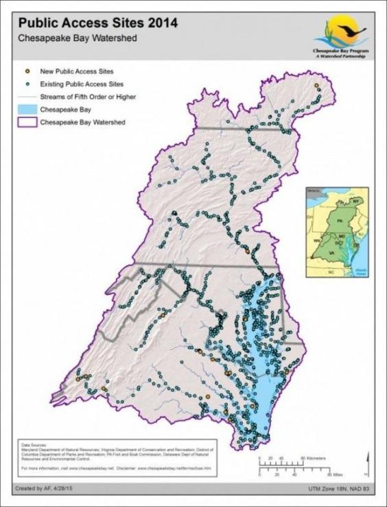
Water, water everywhere, but how to access it? For boaters, anglers, paddlers, and sailors, finding a boat ramp or soft launch is the first step to getting out on the water. More points of access are needed, no doubt, but thanks to the internet and smartphones at least finding the existing launches is easier than ever. Yet Bay enthusiasts clamor for more points of entry spots. And who can blame us?

Since 2010 measurable strides have been made to increase the number of access points to the Bay across the entire Bay watershed. “The 2014 Chesapeake Bay Watershed Agreement includes a goal of expanding public access to the Bay and its tributaries through existing and new local, state, and federal parks, refuges, reserves, trails, and partner sites,” says John Davy, outdoor recreation planner for the National Park Service. “To measure progress towards this goal, the Bay Program has developed a Public Access and Site Development Outcome that states by 2025, 300 new public access sites, with a strong emphasis on providing opportunities for boating, swimming, and fishing where feasible, will be added.” Eighty-six sites have already been added, and 400 potential new sites have been identified. See the box on page 65 for the yearly progress thus far.
“The effort to create additional access points is a partnership between local, state, and federal agencies, along with non-profit organizations,” explains Davy. “A good example of this partnership is the opening of a boat dock, wildlife viewing platform, public pavilion, and fishing access that was established in 2014 at the Zimmerman Center for Heritage on the Susquehanna River. This site received support from Pennsylvania’s Fish and Boat Commission, Department of Conservation and Natural Resources, and Department of Transportation, along with the National Park Service and local donors.”
Other examples of new access points include sites on the Nansemond River in Virginia and Parish Creek in Maryland. On the Nansemond, a tributary of the James River near Norfolk, a 371-foot pier with a fishing platform and floating canoe and kayak launch at Sleepy Hole Park is the newest public access point in the watershed and provides the first direct public access to the river in many years. In Maryland, a new launch for car-top boats opened in Shady Side Park on Parish Creek off the West River in 2014. From the launch site paddlers can reach the beaches of the Shady Cove Natural Area, a peninsula on the West River, and other interesting destinations. For paddlers, access points aren’t just for entry; they’re also necessary for resting spots and final destinations.
What's Stopping Progress?
According to the Chesapeake Bay Program, factors that impede development of public access points include:
- Funding
- Local government capacity
- Permitting requirements
- Restrictions on private lands and public lands
- Conflicts among users
- New sites must be universally accessible
What Can You Do To Help?
- Support state and local planning efforts in developing new access sites.
- Help to assure that needed public access sites are included in local comprehensive land use plans and state outdoor recreational plans.
- Be vigilant; if you see what could potentially be a good public access site, let state and local planning folks or appropriate agencies know about it.
- Volunteer to help maintain or care for existing sites or new ones that are about to be developed (this can help reduce local or state management costs.
 More Places To Get on the Water
In 2014 the Chesapeake Bay Watershed Agreement committed to adding 300 public access points by 2015, for a total of 1439 places to launch boats, fish, swim, or look out over the water. Here's the timeline of progress thus far:
- 2010: 1139 sites identified
- 2011: 15 sites added
- 2012: 18 sites added
- 2013: 36 sites added
- 2014: 17 sites added
- 2015: numbers should be available soon
Total number of public access sites in Bay watershed as of May
2014: 1225, reflecting
86 new sites added and nearly one third of the goal accomplished. Keep in mind that the watershed includes six states and the District of Columbia. Some, such as New York, aren't contiguous with the Bay.
 Since 2010 measurable strides have been made to increase the number of access points to the Bay across the entire Bay watershed. “The 2014 Chesapeake Bay Watershed Agreement includes a goal of expanding public access to the Bay and its tributaries through existing and new local, state, and federal parks, refuges, reserves, trails, and partner sites,” says John Davy, outdoor recreation planner for the National Park Service. “To measure progress towards this goal, the Bay Program has developed a Public Access and Site Development Outcome that states by 2025, 300 new public access sites, with a strong emphasis on providing opportunities for boating, swimming, and fishing where feasible, will be added.” Eighty-six sites have already been added, and 400 potential new sites have been identified. See the box on page 65 for the yearly progress thus far.
“The effort to create additional access points is a partnership between local, state, and federal agencies, along with non-profit organizations,” explains Davy. “A good example of this partnership is the opening of a boat dock, wildlife viewing platform, public pavilion, and fishing access that was established in 2014 at the Zimmerman Center for Heritage on the Susquehanna River. This site received support from Pennsylvania’s Fish and Boat Commission, Department of Conservation and Natural Resources, and Department of Transportation, along with the National Park Service and local donors.”
Other examples of new access points include sites on the Nansemond River in Virginia and Parish Creek in Maryland. On the Nansemond, a tributary of the James River near Norfolk, a 371-foot pier with a fishing platform and floating canoe and kayak launch at Sleepy Hole Park is the newest public access point in the watershed and provides the first direct public access to the river in many years. In Maryland, a new launch for car-top boats opened in Shady Side Park on Parish Creek off the West River in 2014. From the launch site paddlers can reach the beaches of the Shady Cove Natural Area, a peninsula on the West River, and other interesting destinations. For paddlers, access points aren’t just for entry; they’re also necessary for resting spots and final destinations.
What's Stopping Progress?
According to the Chesapeake Bay Program, factors that impede development of public access points include:
 More Places To Get on the Water
In 2014 the Chesapeake Bay Watershed Agreement committed to adding 300 public access points by 2015, for a total of 1439 places to launch boats, fish, swim, or look out over the water. Here's the timeline of progress thus far: